ICEFIELDS PARKWAY, BANFF NATIONAL PARK
Visit Peyto Lake and Bow Summit
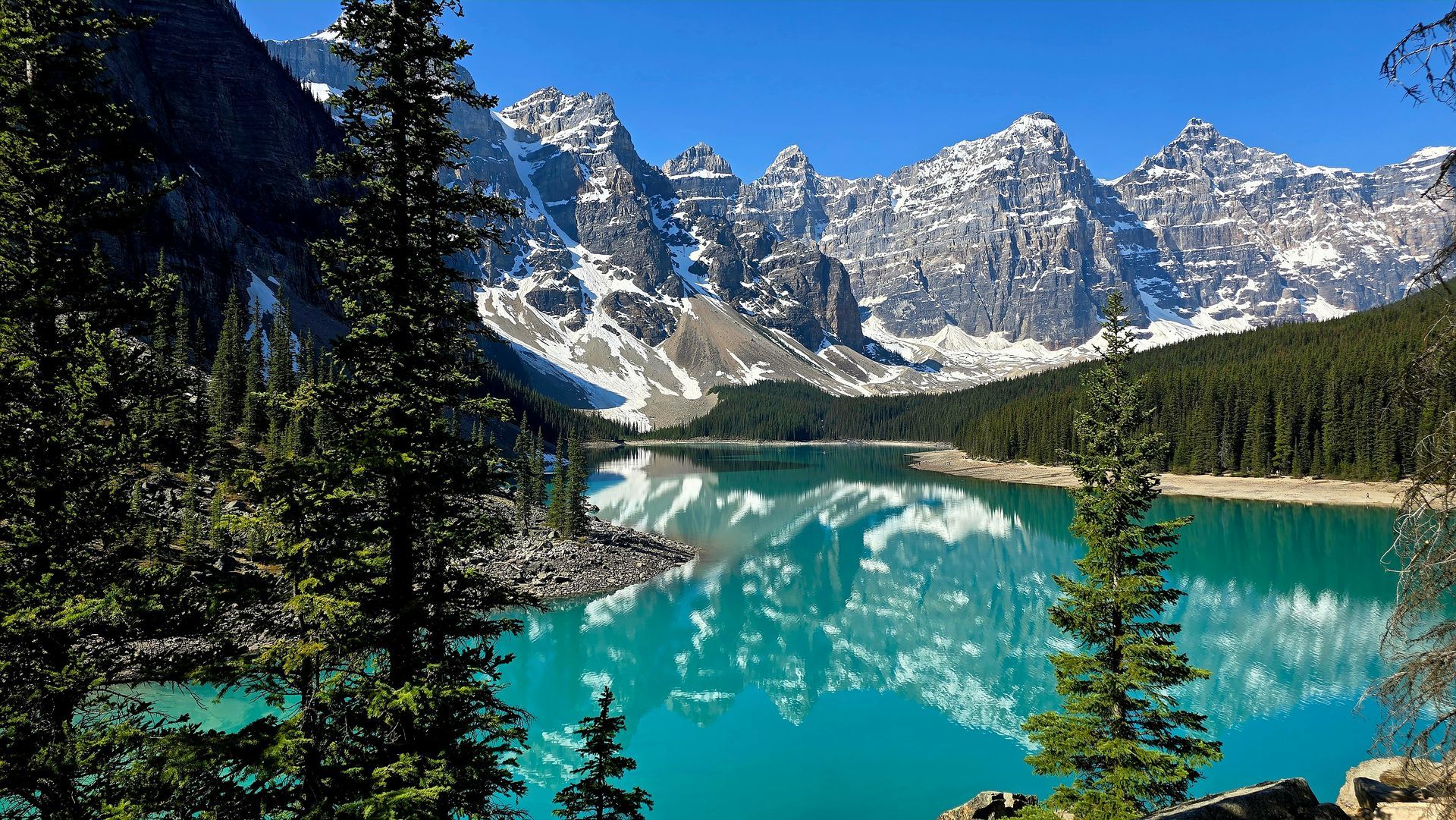
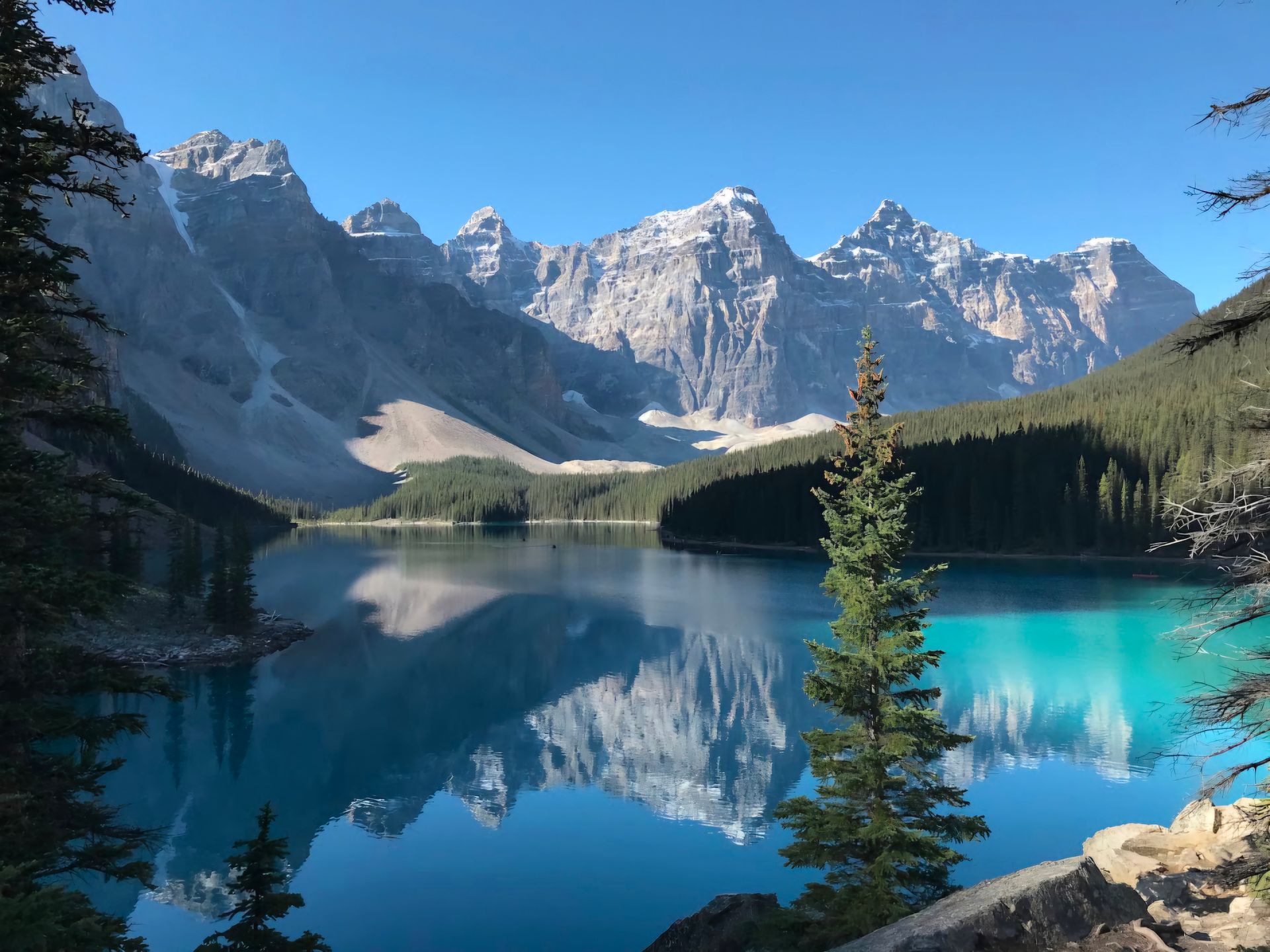
Peyto Lake's wolf-head silhouette, visible only from above the treeline at Bow Summit, is one of the most recognizable views in the Canadian Rockies. The turquoise is glacial flour: fine rock particles suspended in meltwater, scattering blue and green light. The lake sits at 1,880 metres, 40 kilometres north of Lake Louise, at Bow Summit (2,088m), the highest drivable point on the Icefields Parkway. Parking fills by 9:00 AM on peak summer mornings, and there is no public transit. Canmore Travel runs private tours and transfers from Canmore, Harvie Heights, and Banff, and regularly pairs Peyto Lake with Bow Lake in a single Parkway day.
How Canmore Travel fits in: We provide private guided tours and transfers to Peyto Lake and the Icefields Parkway from Canmore, Harvie Heights, and Banff. We do not sell tickets to third-party attractions
What to See at Peyto Lake and Bow Summit
Peyto Lake rewards visitors who arrive with good timing and a clear morning. The guide below covers the viewpoints, the summit terrain, and the best window for each season.
The Viewpoint
Bow Summit
When to Visit
The Viewpoint
The lake’s distinctive shape is only visible from elevation. Two viewpoints rise above the treeline from the Bow Summit parking area: a paved accessible platform and a higher, quieter extended trail. Both look out over the same turquoise wolf-head silhouette, but from different angles and crowd levels.
The trail from the Bow Summit parking area to the main viewing platform is 0.6 kilometres return, paved, and accessible to most visitors including those with limited mobility. The platform sits above the treeline with an unobstructed view across the lake and valley. The wolf-head shape, formed by Caldron Creek flowing into the lake’s north end and creating the distinctive snout, is clearly visible only from this elevation. Most visitors spend 30 to 60 minutes here before continuing on the Parkway.
The Viewpoint
Peyto Lake Main Viewpoint
Arrive before 8:30 AM or after 4:00 PM in summer to avoid the busiest window at the parking area.
The Viewpoint
Upper Extended Viewpoint
A secondary trail from the main platform continues uphill to a higher viewpoint, adding roughly 1 kilometre and 100 metres of elevation gain. The upper platform offers a wider, higher perspective across Bow Summit and better sightlines toward the Peyto Glacier on the Waputik ridgeline. It is consistently quieter than the main platform even when the parking area is full. The upper trail is typically accessible from late June through early October, depending on snow conditions.
Upper trail accessible late June through early October. No card note required if conditions are clear from the text.
The wolf-head silhouette forms because Caldron Creek flows into the north end of the lake and creates a sandy delta that pinches in, producing the snout. The turquoise colour comes from glacial flour: fine rock particles ground by the Peyto Glacier above, suspended in the meltwater and scattering blue and green light. The colour is most intense from late June through early August when glacier melt is at its peak. The lake is named after Bill Peyto, a legendary wilderness guide who worked in the Canadian Rockies in the late 1800s and early 1900s.
The Viewpoint
The Wolf Head Shape and Turquoise Colour
Bow Summit and the Continental Divide
Bow Summit at 2,088 metres is the highest point on the Icefields Parkway reachable by road. The terrain here is open subalpine: no treeline, wide sky, wildflowers in season, and wildlife that does not appear at lower elevations on the Parkway. Even the drive up rewards a stop.
At 2,088 metres, Bow Summit is the highest elevation reachable by vehicle on the Icefields Parkway. The crossing passes through open subalpine terrain where the forest gives way to low shrubs, tundra vegetation, and wide sky. In clear conditions, Bow Lake is visible far below to the south and the Mistaya River Valley stretches north beyond Peyto Lake. The summit sits on a Continental Divide watershed: rain and snow melting south flows toward the Bow River and eventually the Atlantic Ocean. Water flowing north drains toward the North Saskatchewan River and Hudson Bay.
Bow Summit
Highest Drivable Point on the Parkway
Temperatures at 2,088m run significantly cooler than Banff or Canmore. Bring a wind layer regardless of the season.
From late June through late August the meadows at Bow Summit carry a bloom of subalpine wildflowers: Indian paintbrush, alpine forget-me-nots, white mountain heather, and purple fleabane. Wildlife is active in this zone year-round. Golden-mantled ground squirrels are common near the parking area. Clark’s nutcrackers work the treeline below. In late summer and early fall, bears feeding on berry patches near the summit are occasionally spotted from the road. Temperatures at 2,088 metres run significantly cooler than Banff or Canmore, and afternoon thunderstorms are common in July and August.
Bow Summit
Wildlife and Wildflowers
Always carry a wind layer at Bow Summit. Summer conditions can shift quickly at this elevation.
When to Visit Peyto Lake
Peyto Lake is accessible year-round by vehicle, but the viewpoint experience changes dramatically across the seasons. Timing your visit right makes the difference between the iconic shot and a parking lot queue.
The main viewpoint trail is typically clear by mid-June. The upper trail may still hold snow into late June. Glacier melt is accelerating and turquoise builds through the month. Crowds are manageable before the Canada Day long weekend.
June
The turquoise is at its most intense in mid-July when glacial melt is highest. Wildflowers bloom across the Bow Summit meadows. Parking fills before 9:00 AM. Arrive before 8:30 AM or plan an evening visit after 4:00 PM to avoid the busiest window.
July to August
Crowds drop significantly after Labour Day. Weather is generally stable through mid-September. The lake holds colour well into fall and the surrounding terrain takes on golden tones. Larch colour begins below the summit later in the month.
September
The Icefields Parkway remains open through winter. Snow arrives at Bow Summit by October and the upper viewpoint trail is not maintained in winter. The main platform may be accessible in good conditions. Carry winter gear and check road conditions before departure.
October to May
Ready to Visit Peyto Lake?
Canmore Travel runs private tours and transfers along the Icefields Parkway with convenient pickup locations across Canmore, Harvie Heights, and Banff. Regularly pairs Peyto Lake with Bow Lake in a single Parkway day.